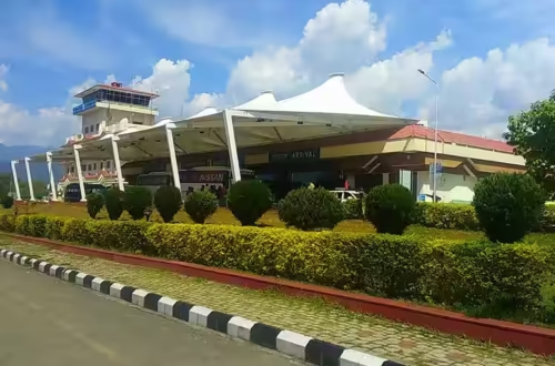
The Barak Valley in southern Assam is geographically separated from the Brahmaputra Valley — the two halves of the state are divided by dense forested hills and a road corridor that can be slow and flood-prone. For the people of Silchar, Karimganj, and Hailakandi, Silchar Airport is not a convenience but a lifeline, particularly when the monsoon disrupts road and rail links. Built in 1944 as RAF Station Kumbhirgram during World War II, the airport has served this isolated southern pocket of Assam through eight decades of evolution. It now functions as the fourth busiest airport in northeast India — a remarkable ranking for a terminal that covers just 36.70 acres and operates from a single runway shared with the Indian Air Force.
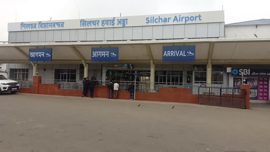
Quick Overview: Silchar Airport
| Detail | Information |
| Official Name | Silchar Airport |
| Also Known As | Kumbhirgram Airport |
| Location | Kumbhirgram, Silchar, Assam |
| Serves | Silchar, Barak Valley (Cachar, Karimganj, Hailakandi) |
| Airport Type | Public/Military — Domestic (Civil Enclave) |
| IATA Code | IXS |
| ICAO Code | VEKU |
| Owner | Indian Air Force |
| Operator | Indian Air Force and Airports Authority of India (AAI) |
| Opened | 1944 |
| Total Land Area | 36.70 acres |
| Runway Designation | 06/24 (single asphalt runway) |
| Runway Length | 7,500 ft (approx. 2,286 m) |
| Elevation | 352 ft / 107 m AMSL |
| Distance from City | ~22–29 km from Silchar city centre |
| Passengers (2024–25) | 4,83,464 |
| Current Airlines | IndiGo (primary) |
Silchar Airport Location: Kumbhirgram at the Barail Foothills
Silchar Airport is located at Kumbhirgram, Assam 788031, set against the foothills of the Barail mountain ranges that form the southern boundary of the Barak Valley. The distance between the airport and Silchar city centre varies across sources — most place it between 22 and 29 kilometres, with travel time of approximately 45 minutes to one hour depending on traffic and road conditions. The airport address is Kumbhirgram Airport Road, Silchar 788109, Assam.
The Barail backdrop gives the airport a distinctive natural setting, but it also contributes to weather variability — low cloud and fog can affect operations particularly in winter and monsoon months. The airport sits at an elevation of 352 feet above mean sea level and is approximately 407 kilometres from Dispur (Assam’s capital) and 434 kilometres from Guwahati Airport, underscoring the geographic isolation that makes this airport critical for the Barak Valley.
As a military-civilian shared facility, the airport is owned by the Indian Air Force and operated jointly by the IAF and AAI, a structural arrangement that gives the IAF ultimate control over the aerodrome while AAI manages civilian passenger operations in the civil enclave.
Silchar Airport Code: IATA IXS and ICAO VEKU
The airport’s IATA code is IXS and its ICAO code is VEKU. IXS appears on all airline booking platforms, boarding passes, and baggage systems for travellers using Silchar. The airport is frequently listed as Kumbhirgram Airport — derived from the locality name — across older databases and some booking platforms. Both names refer to the same facility with the same codes.
Silchar Airport Terminal: Single Domestic Building for the Barak Valley
Silchar Airport operates from a single domestic terminal — Terminal 1 — which handles all arrivals and departures. The terminal was built and improved over several phases and covers an area of approximately 2,586 square metres. It can handle 300 passengers simultaneously — 150 in the departure section and 150 in arrivals. Five check-in counters and two security screening points manage passenger flow.
The terminal’s capacity relative to the airport’s traffic volumes — nearly half a million passengers in 2024–25 — has long been a point of concern. Despite being the fourth busiest airport in northeast India, the facility has the physical footprint of a small regional terminal, and peak hour pressure is tangible. AAI has been working on modernising the infrastructure, and plans to expand further are part of a broader push to upgrade connectivity for the Barak Valley.
The runway at 7,500 feet is shared with the Indian Air Force’s fighter operations, meaning the maintenance schedule and access protocols are governed by IAF priorities — the same dynamic that necessitated the long shutdowns at comparable civil enclaves elsewhere in the northeast.
Silchar Airport Connectivity: Airlines, Routes and Ground Transport
By Air: IndiGo is the primary scheduled commercial carrier at Silchar, with direct connections to Kolkata, Guwahati, and Imphal. Approximately 32 flights per week operate through this airport across various routes. IndiGo has also launched Mumbai connectivity via Kolkata. Routes have historically also included Agartala. Confirm current active schedules on airline platforms before travel, as northeast routes are subject to seasonal and operational changes.
By Road: Prepaid taxi services and auto-rickshaws operate from counters outside the terminal. App-based cabs like Uber do not function within Silchar itself — local cabs are the standard option for city transport. Travel time to the city centre is approximately 45 to 60 minutes. APSRTC-equivalent state transport does not serve the airport directly; private taxis are the primary mode.
By Rail: Silchar Railway Station connects the city to the broader Indian rail network, though the rail link through the hill corridor between Assam’s two valleys is a long journey. The station is the primary alternative to air travel for longer-distance trips from the Barak Valley.
Nearest Alternative Airports: Lengpui Airport in Mizoram is approximately 180 km away. Guwahati’s LGBIA is the nearest international hub, roughly 330 km to the north.
Silchar Airport Amenities: What the Terminal Offers
Despite its compact size, Silchar Airport provides a reasonable range of passenger services. Free Wi-Fi is available throughout the terminal. A small cafeteria serves snacks, beverages, and light meals. Baggage handling and trolleys ensure smooth luggage management. A first-aid medical centre operates for emergencies. Mobile charging points are available in the departure section. Parking space for private vehicles and taxis is provided near the terminal.
Prepaid taxi and auto-rickshaw services have dedicated counters outside the arrivals exit. There are no commercial lounges, duty-free retail areas, or premium dining options given the terminal’s scale. The overall amenity experience is functional and practical — appropriate for a facility whose primary value to its passengers is the flight connection itself, not the airport dwell time.
FAQs: Silchar Airport
Q1. What is the IATA code for Silchar Airport?
The IATA code is IXS and the ICAO code is VEKU. The airport is also known as Kumbhirgram Airport, located in Kumbhirgram, southern Assam.
Q2. Which airlines and routes operate from Silchar Airport?
IndiGo is the primary carrier, with flights to Kolkata, Guwahati, Imphal, and Mumbai (via Kolkata). Around 32 flights per week operate from this airport. Current schedules should be confirmed before booking.
Q3. How far is Silchar Airport from the city centre?
The airport is approximately 22 to 29 km from Silchar city centre, with travel time around 45 to 60 minutes by local taxi or auto-rickshaw.
Q4. Are app-based cabs available at Silchar Airport?
No. Uber and similar app-based services do not operate in Silchar. Local taxis and prepaid cab counters outside the terminal are the transport options.
Q5. Why is Silchar Airport so important to the Barak Valley?
The Barak Valley is geographically isolated from the rest of Assam by forested hills. During monsoon flooding, road and rail links can be disrupted for days. The airport is often the only reliable connection to Guwahati, Kolkata, and other cities during those periods.