
The Jamshedpur connection in Chakulia Airport’s story is geographic more than administrative — the airport at Chakulia in Purbi Singhbhum district is approximately 75 kilometres from Jamshedpur city and serves no current commercial aviation function for Jamshedpur residents. What Chakulia does have is one of the more historically significant airfield stories in eastern India: built in 1942 by the British firm Das & Mohanty Construction Company for the United States Army Air Forces Tenth Air Force, it hosted the 341st Bombardment Group’s B-25 Mitchell bombers flying missions against Japanese targets in Burma, and crucially became one of the first bases for the Boeing B-29 Superfortress in April 1944 — with the inaugural B-29 landing at Chakulia on 2 April 1944. The airfield also served as a ferry staging point for aircraft crossing the Himalayas into China. Post-war, it passed to India and has since sat in various states of dormancy, carrying ICAO code VECK but no IATA code and no scheduled commercial flights.
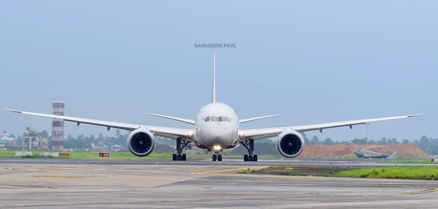
Quick Overview: Chakulia Airport
| Detail | Information |
| Airport Name | Chakulia Airport |
| Location | Southwest of Chakulia town, Purbi Singhbhum district, Jharkhand |
| Serves (Reference) | Jamshedpur (~75 km), Kharagpur (~65 km, West Bengal) |
| Airport Type | Public — Disused civil airfield |
| IATA Code | Not Assigned |
| ICAO Code | VECK |
| Owner | Airports Authority of India (AAI) |
| Coordinates | 22°28′00.49″N, 86°42′38.52″E |
| Elevation | 129–131 m / 423–430 ft AMSL |
| Nearest Weather Station | Deoghar Airport (~74 km) |
| Flight Information Region | Kolkata FIR |
| Historical Use | USAAF WWII base (1942–1945); B-25 Mitchell; B-29 Superfortress |
| Current Use | Disused; no scheduled flights; no current commercial operations |
| Scheduled Commercial Flights | None |
Chakulia Airport Location: Purbi Singhbhum Near the Jharkhand–West Bengal Border
Chakulia Airport is located southwest of Chakulia town in Purbi Singhbhum district, eastern Jharkhand. Coordinates are 22°28′00.49″N, 86°42′38.52″E, at an elevation of approximately 129 to 131 metres above mean sea level. The flat terrain of the Jharkhand–West Bengal border zone supported the development of a wartime airfield here with minimal earthwork.
The airport sits approximately 75 km from Jamshedpur (Tata Steel’s city) and approximately 65 km from Kharagpur in West Bengal — the latter housing IIT Kharagpur and a significant railway junction. The location near the Bengal border, and roughly equidistant between two important eastern Indian cities, gave Chakulia strategic military value in 1942 and has given it a theoretical commercial catchment case in discussions about revival — though neither city has prioritised Chakulia over their own closer airport projects.
Nearby airfields in pilot navigation databases include Sonari Airport (IXW, Jamshedpur, approximately 75 km northwest), Deoghar Airport (DGH, approximately 74 km north), Kazi Nazrul Islam Airport in Durgapur, and Burnpur Airport. The nearest weather station is Deoghar Airport, approximately 74 km north.
Chakulia Airport Code: ICAO VECK — No IATA Code
Chakulia Airport carries the ICAO code VECK. No IATA code has been assigned, consistent with a disused airfield that has no scheduled commercial passenger operations. VECK places it in the VE eastern India block. The airport does not publish METAR weather data.
Chakulia Airport Terminal: A WWII Airfield in Long-Term Dormancy
Chakulia’s operational history runs almost exclusively in the wartime 1942 to 1945 window. The original airfield was constructed in late 1942 by Das & Mohanty Construction Company for the USAAF Tenth Air Force China-Burma-India theater of operations. The 341st Bombardment Group operated B-25 Mitchell medium bombers from here on raids against Japanese positions in Burma. The airfield then transitioned to host the 40th Bombardment Group and became one of the first B-29 Superfortress bases in the entire Allied war effort, with the first B-29 landing at Chakulia on 2 April 1944. The B-29 was the most advanced strategic bomber of World War II — capable of intercontinental bombing from high altitudes — and its early deployment to Chakulia was part of Operation Matterhorn, the strategic bombing campaign against Japanese-controlled targets in China and Southeast Asia.
Following Japan’s surrender in 1945, the USAAF vacated Chakulia and the airfield reverted to British Indian administration. After Indian independence in 1947, the airfield passed to the Government of India and subsequently to AAI. It has not hosted scheduled commercial operations in the post-independence era.
The infrastructure at Chakulia consists of the WWII-era airfield footprint — runways that date to wartime construction and have received only basic maintenance — without a modern passenger terminal, commercial check-in infrastructure, or airline-ready facilities. The site’s wartime heritage is its most remarkable feature, but it has not translated into modern aviation development.
There is no confirmed proposal, funded project, or development timeline for commercial revival at Chakulia Airport as of mid-2026. It sits in the broader context of eastern Jharkhand’s aviation underdevelopment, where Jamshedpur’s immediate aviation needs are addressed (inadequately, and with frequent disruptions) by the city-centre Sonari Airport, and the proposed Dhalbhumgarh greenfield airport is expected to eventually replace Sonari as Jamshedpur’s aviation gateway.
Chakulia Airport Connectivity: No Commercial Flights; Road Access Only
By Air: No scheduled commercial passenger flights operate from Chakulia Airport and none are planned as of mid-2026. The airfield is disused for any regular civil aviation purpose.
By Road: Chakulia town is connected by road to Jamshedpur (approximately 75 km northwest, 1.5 to 2 hours), Dhalbhumgarh (approximately 25 km south), Kharagpur, West Bengal (approximately 65 km east), and Bhubaneswar (approximately 350 km via NH-49 south). State and national highway connections provide access to Jamshedpur’s industrial zone and to West Bengal.
By Rail: Chakulia Railway Station is on the Howrah–Mumbai main line (South Eastern Railway), one of India’s busiest rail corridors. This rail connectivity is actually one of the most significant pieces of infrastructure near the airfield — the Howrah–Mumbai main line provides fast rail access to Kolkata, Jamshedpur (Tatanagar station), and beyond. The railway station proximity has historically been cited as a reason why commercial aviation demand at Chakulia is diffuse rather than concentrated.
Nearest Commercial Airport: Sonari Airport (IXW, Jamshedpur) at approximately 75 km northwest was the nearest commercial airport until early 2026, when IndiaOne Air suspended the Jamshedpur routes. As of mid-2026, the nearest operational commercial airports are Deoghar (DGH, approximately 74 km north via road) and Kazi Nazrul Islam Airport in Durgapur, West Bengal, with connections to Kolkata.
Chakulia Airport Amenities: No Public-Facing Facilities
There are no public passenger amenities at Chakulia Airport. The disused wartime airfield has no terminal building, no check-in counters, no departure lounge, no food services, and no commercial infrastructure for passengers. The site is maintained at a minimal level as an AAI asset.
The historical significance of the airfield — as the site where B-29 Superfortresses first landed in Asia and from which Allied bombing campaigns against Japanese targets in Burma were launched — is the facility’s most compelling characteristic. That heritage has not been developed into an aviation museum or educational facility, though the wartime history of eastern India’s USAAF bases including Chakulia is increasingly documented by aviation history researchers.
FAQs: Chakulia Airport
Q1. Does Chakulia Airport have an IATA code?
No. Chakulia Airport carries only the ICAO code VECK. No IATA code has been assigned as the airport has no scheduled commercial passenger operations.
Q2. What is the historical significance of Chakulia Airport?
Chakulia was built in 1942 for the USAAF Tenth Air Force in the China-Burma-India theater of WWII. The 341st Bombardment Group flew B-25 Mitchell bombing raids against Japanese positions in Burma from here. On 2 April 1944, the first B-29 Superfortress heavy bomber landed at Chakulia — one of the earliest B-29 deployments in the Allied war effort. The airfield was also a ferry staging point for aircraft crossing the Himalayas into China.
Q3. Why is Chakulia Airport associated with Jamshedpur?
The airport at Chakulia is approximately 75 km southeast of Jamshedpur and is listed in aviation databases as serving Jamshedpur and Kharagpur. It is the nearest large disused airfield to Jamshedpur, though the city’s primary (and currently intermittent) commercial aviation uses Sonari Airport within the city.
Q4. Is there any plan to revive Chakulia Airport for commercial use?
No confirmed development plan or funded project for commercial revival exists at Chakulia as of mid-2026. Jamshedpur’s aviation future is officially directed toward the proposed Dhalbhumgarh greenfield airport, which would be developed on a separate WWII-era airfield site closer to the city.
Q5. What is the nearest commercial airport to Chakulia?
Deoghar Airport (DGH) at approximately 74 km north is the nearest with current scheduled service (IndiGo to Delhi, Kolkata, Bengaluru, Mumbai). Sonari Airport (IXW, Jamshedpur) at approximately 75 km northwest had commercial services suspended in early 2026.


