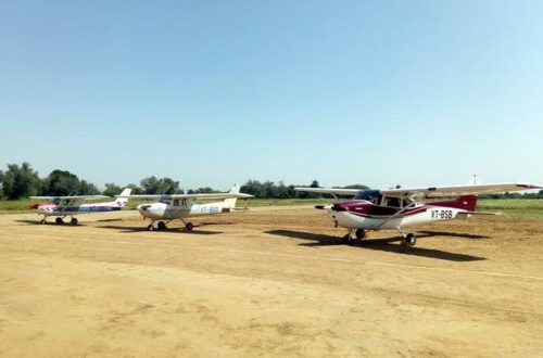
Kailashahar is the district headquarters of Unakoti district in northern Tripura — a small town on the Manu River notable for two things that exist at almost opposite ends of the human scale: the Unakoti rock-cut sculptures, a remarkable 9th-to-10th century Shaiva pilgrimage site where massive bas-relief images of Shiva, Vishnu, Ganesha, and Nandi are carved into the hillside in numbers said to be 99,99,999 (one less than a crore — the name itself means “one less than a crore”), and the strategic proximity to the Bangladesh border and the Mizoram-Assam-Tripura corridor. Kailashahar Airport carries IATA code IXH and ICAO code VEKR. It was shut down in mid-1990 due to lack of space. The 1,006-metre runway (3,300 feet) on 61 acres needs 700 metres of additional land in the northern part before any commercial revival is possible. Multiple revival discussions — an AAI survey in December 2021, a state delegation visit in August 2023, a high-level Chief Minister-chaired review meeting, and AAI’s Northeast Regional Executive Director’s site visit in May 2025 — have kept the prospect alive. No scheduled commercial flights operate as of mid-2026.
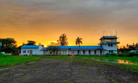
Quick Overview: Kailashahar Airport
| Detail | Information |
| Airport Name | Kailashahar Airport |
| Location | Kailashahar, Unakoti district, Tripura, India |
| Airport Type | Public — Non-operational |
| IATA Code | IXH |
| ICAO Code | VEKR |
| Operator | Airports Authority of India (AAI) |
| Shut Down | Mid-1990 (lack of space) |
| Runway Designation | 03/21 (IndiaAirport); 3/21 (pilot databases) |
| Runway Length | ~1,006 m (3,300 ft) — existing |
| Runway Extension Needed | ~700 m (northern part — land acquisition required) |
| Elevation | 24 m / 79 ft AMSL |
| Coordinates | 24°18′29″N, 92°00′26″E |
| Nearest Commercial Airport | Maharaja Bir Bikram Airport, Agartala (IXA) |
| Nearest Airstrip | Kamalpur Airport (~27.7 km) |
| Nearest Weather Station | Hazrat Shahjalal International Airport, Dhaka (~171 km) |
| Flight Information Region | Kolkata FIR |
| Scheduled Commercial Flights | None |
| Revival Meetings | AAI survey Dec 2021; State delegation Aug 2023; CM meeting and AAI site visit May 2025; CM-chaired review Feb 2026 |
Kailashahar Airport Location: Northern Tripura’s Strategic Outpost
Kailashahar Airport is located in Kailashahar town, district headquarters of Unakoti district, at coordinates 24°18′29″N, 92°00′26″E, elevation 24 metres. The town sits on the Manu River in northern Tripura — the most geographically isolated corner of the state, approximately 170 km from Agartala by road through hilly terrain.
The strategic dimension of Kailashahar’s revival has been emphasised in recent policy discussions. Bangladesh’s renovation of Lalmonirhat Airport near the India-Bangladesh border — reportedly with Chinese technical assistance — has raised concerns about dual-use capabilities near the Chicken’s Neck corridor. Reviving Kailashahar would give the IAF a forward base for rapid deployment, refuelling, and emergency operations near this sensitive corridor, while providing civilian connectivity for a chronically underserved district.
The Unakoti sculptures are the primary tourism draw — 9th to 10th century rock carvings on a hillside approximately 8 km from Kailashahar attract pilgrims and heritage tourists. Better air connectivity would significantly expand visitor numbers from mainland India.
Code, Terminal and Revival Status
IATA IXH and ICAO VEKR are the assigned codes. The airport has no active commercial operations, no METAR data, and does not appear in any airline booking system.
AAI’s Northeast Regional Executive Director and the MBB Airport Director visited Kailashahar on 27 May 2025 to assess the ground situation following a state government request. A CM Dr. Manik Saha-chaired high-level review meeting in February 2026 discussed runway expansion, modern infrastructure, and capacity for larger aircraft. AAI agreed to send a technical and operational team for detailed land assessment.
The primary obstacle remains land — 700 metres of additional runway length is needed to the north of the existing 1,006-metre strip, requiring state government land acquisition. Until this is completed and AAI implements the necessary CNS/ATM systems, no commercial flight can operate.
Connectivity and Amenities
By Air: No scheduled flights. MBB Airport Agartala (IXA) is the nearest commercial airport — approximately 4 to 5 hours by road from Kailashahar through Tripura’s hilly terrain.
By Road: Kailashahar to Agartala takes approximately 4 to 5 hours by road. To Kamalpur (Dhalai district) approximately 27 km. TRTC buses operate from Kailashahar.
No public passenger amenities for commercial aviation exist.
FAQs: Kailashahar Airport
Q1. What is the IATA code for Kailashahar Airport?
IXH is the IATA code and VEKR is the ICAO code. The airport is in Kailashahar, Unakoti district, northern Tripura, non-operational since mid-1990.
Q2. Why was Kailashahar Airport shut down?
The airport was closed in mid-1990 due to lack of space — the 1,006-metre runway is too short for commercial operations and cannot be extended without additional land to the north.
Q3. What is needed to revive Kailashahar Airport?
Approximately 700 metres of additional land in the northern part for runway extension, plus AAI investment in CNS/ATM systems, terminal, and navigational aids. A CM-chaired review in February 2026 discussed these requirements.
Q4. What is the Unakoti heritage site near Kailashahar?
The Unakoti rock-cut sculptures — massive 9th-to-10th century Shaiva carvings on a hillside approximately 8 km from Kailashahar — are one of Northeast India’s most significant heritage and pilgrimage sites.
Q5. Is there a strategic reason to revive Kailashahar Airport?
Yes. The airport’s location near the Bangladesh border and the Chicken’s Neck corridor, combined with Bangladesh’s Lalmonirhat renovation with Chinese assistance, has given Kailashahar revival added strategic priority beyond civilian connectivity.