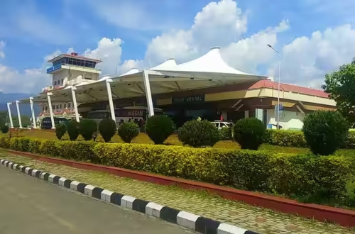
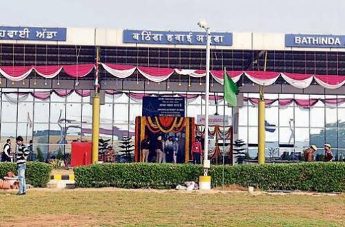
Pinjore sits in the Panchkula district of Haryana, pressed against the lower Shivalik hills where the plains begin to fold upward toward Kalka and the Himalayan foothills beyond. The Yadavindra Gardens — a Mughal-style terraced garden dating to the 17th century — are Pinjore’s most recognisable landmark. The aerodrome here occupies 96 acres on the Pinjore–Baddi highway, established in 1991 as a flying club and the home base of the Haryana Institute of Civil Aviation. ICAO code VI71 is assigned; no IATA code exists. The aerodrome carries four aircraft, a single runway, and a reputation among Haryana’s aviation community as the most scenically situated of the state’s training airfields — the lower Shivalik range and the Morni Hills visible from the apron on clear days, with crosswinds from the hills providing an additional training challenge between March and May.
Quick Overview: Pinjore Aerodrome
| Detail | Information |
| Official Name | Pinjore Aerodrome / Pinjore Airfield and Flying Club |
| Also Known As | Kalka Airport |
| Location | Pinjore–Baddi Highway, Panchkula District, Haryana |
| Serves | Pinjore, Kalka, and the Panchkula-Chandigarh sub-region |
| Airport Type | Public — Pilot Training / General Aviation |
| IATA Code | Not Assigned |
| ICAO Code | VI71 (pseudo-ICAO; informal designator) |
| Owner | Civil Aviation Department, Government of Haryana |
| Operator | Haryana Institute of Civil Aviation (HICA) |
| Website | haraviation.gov.in |
| Land Area | 96 acres |
| Runway Designation | 16/34 |
| Runway Orientation | 159°–336° |
| Elevation | 536.4 m / 1,760 ft AMSL |
| Coordinates | 30°49′16″N, 76°53′30″E |
| Aircraft Based | 4 |
| Established | 1991 |
| Night Operations | No |
| Radio Navigation Aids | None |
| Primary Use | HICA pilot training; VIP charter; government helicopters |
| Scheduled Commercial Flights | None |
| Nearest Weather Station | Dehradun Jolly Grant Airport (~143 km) |
Pinjore Aerodrome Location: The Shivalik Foothills Setting
Pinjore Aerodrome is located on the Pinjore–Baddi main highway in Panchkula district, near the towns of Kalka and Pinjore in northeastern Haryana. Coordinates are 30°49′16″N, 76°53′30″E, at an elevation of 536.4 metres above mean sea level — making it the highest of Haryana’s civil airstrips, reflecting its position in the transitional terrain between the Punjab plains and the Shivalik Hills.
The aerodrome’s setting is genuinely distinctive among Haryana’s flying facilities. The lower Shivalik range and the Morni Hills — Haryana’s only significant hill terrain — are visible on the horizon from the airfield. The Pinjore–Baddi highway corridor connects Panchkula’s industrial zones to the Baddi pharmaceutical cluster in Himachal Pradesh. This makes the aerodrome adjacent to one of the more economically active sub-regional corridors in northern Haryana, though aviation demand for commercial services here has never crystallised into a commercial airport proposal.
Proximity to Chandigarh is the defining geographic reality. Chandigarh Airport (IXC) is approximately 25 to 30 kilometres from Pinjore — close enough that any commercial aviation demand from the area is entirely absorbed by what is already one of the better-served Tier 2 airports in northern India. This proximity is the primary reason Pinjore has remained a training aerodrome rather than evolving toward commercial operations.
Pinjore is also known for the Yadavindra Gardens (Pinjore Gardens), a Mughal-style garden laid by Nawab Fidai Khan on behalf of Aurangzeb, later taken over by the Patiala royal family and now maintained by the Haryana Tourism Corporation. The garden is approximately 5 kilometres from the aerodrome. The Bhima Devi Temple Museum, with its remarkable collection of medieval temple sculpture, is in the same area.
Nearby airfields in pilot navigation databases include Chandigarh Airport (Shaheed Bhagat Singh International Airport), Shimla Airport, Ambala Air Force Station, Patiala Airport, and Ludhiana Airport. The nearest weather station is Dehradun’s Jolly Grant Airport, approximately 143 km east — a notably distant reference station that reflects the lack of aviation weather reporting in this sub-region.
Pinjore Aerodrome Code: ICAO VI71 — No IATA Code
Pinjore Aerodrome carries the informal ICAO designator VI71. Like Karnal (VI40) and other Haryana civil airstrips, VI71 is a pseudo-ICAO code rather than a formally registered standard four-letter designator — used in pilot navigation databases and India AIP for positional identification. No IATA code has been assigned. No METAR data is published. The Flight Information Region is Delhi FIR.
Pinjore Aerodrome Terminal: HICA Home Base With Training Aircraft
Pinjore Aerodrome is the home base of the Haryana Institute of Civil Aviation, making it the institutional headquarters of Haryana’s civil aviation training system rather than a standalone flying club at a secondary site. The facility supports four aircraft based on the aerodrome — a mix consistent with commercial pilot training operations at a regional flying school.
The runway is designated 16/34, oriented at 159°–336°, and is restricted to day visual flight rules (VFR) operations only. Night flying is not conducted at Pinjore. There are no radio navigational aids at the airfield — pilots operating here use dead reckoning and visual navigation. The elevation at 536.4 metres above sea level and the nearby hill terrain create specific training conditions, including crosswinds that blow off the Shivalik ridgeline particularly between March and May — a natural training challenge that HICA instructors incorporate into syllabus planning.
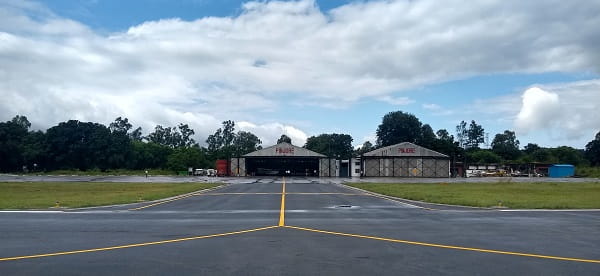
The 96-acre site provides the runway, apron, aircraft parking, hangars, and the administrative infrastructure of HICA’s headquarters. Haryana Government VIP and charter aircraft also use the aerodrome, and government helicopter movements for VIP access to Panchkula district and the Kalka–Shimla belt have historically used Pinjore as a staging point. The aerodrome was also included in the 2023 Haryana Civil Aviation Department tender for Flight Training Organisation (FTO) engagement alongside Bhiwani, Narnaul, Hisar, and Karnal.
No commercial terminal building exists. No check-in facilities, security screening, departure lounge, or baggage handling for public passengers have been developed.
Pinjore Aerodrome Connectivity: Training and VIP Operations Only
By Air: No scheduled commercial passenger flights operate from Pinjore Aerodrome as of mid-2026. HICA’s pilot training operations constitute the primary flying activity. VIP and government charter aircraft and helicopters use the aerodrome for official access to Panchkula district.
By Road: Pinjore and Kalka are connected by road to Chandigarh (approximately 25 to 30 km south) via NH-22 and connecting roads. The Pinjore–Baddi highway provides direct access to Baddi’s pharmaceutical and industrial cluster in Himachal Pradesh (approximately 30 km). The aerodrome’s location on the highway makes it road-accessible without navigating urban congestion. The Kalka–Shimla road — the primary route to Himachal Pradesh’s hill areas — passes through Kalka, approximately 5 km from the aerodrome.
By Rail: Kalka Railway Station, approximately 5 kilometres from the aerodrome, is the terminus of the Kalka–Shimla UNESCO Heritage Railway and also a junction for broad-gauge services to Chandigarh, Ambala, and Delhi. The Kalka–Shimla toy train, one of the most famous narrow-gauge heritage railways in India, departs from here. The broad-gauge service to Chandigarh takes approximately 30 to 40 minutes.
Nearest Commercial Airport: Chandigarh Airport (Shaheed Bhagat Singh International Airport, IXC) at approximately 25 to 30 km is the nearest commercial airport — exceptionally close by the standards of the other Haryana airstrips in this series. This proximity means there is no practical commercial aviation gap for Pinjore Aerodrome to fill.
Pinjore Aerodrome Amenities: Aviation Training Facilities Only
Pinjore Aerodrome’s amenities are those of a functioning flying school and HICA headquarters — aircraft hangars, training infrastructure, administrative offices, and basic airside support. Four aircraft are based here for pilot training operations. There are no public passenger amenities of any kind: no terminal building, no check-in counters, no lounge, no food service, and no baggage handling.
The surrounding area near Pinjore and Kalka has reasonable accommodation and dining options given the proximity to Chandigarh and the tourist traffic to Pinjore Gardens. Travellers in the area seeking commercial air connectivity use Chandigarh Airport, accessible by road in under an hour from Pinjore.
FAQs: Pinjore Aerodrome
Q1. Does Pinjore Aerodrome have an IATA code?
A: No. Pinjore Aerodrome carries only the informal ICAO designator VI71, which is a pseudo-code used in navigation databases rather than a formally registered ICAO designation. No IATA code has been assigned.
Q2. What is the Haryana Institute of Civil Aviation (HICA) connection to Pinjore?
A: HICA’s home base is at Pinjore Aerodrome, making this the institutional headquarters of Haryana’s state civil aviation training system. HICA offers CPL, PPL, SPL, and glider training across its Haryana network of airstrips.
Q3. Are there commercial flights from Pinjore Aerodrome?
A: No. The aerodrome operates exclusively for pilot training, HICA administrative functions, and VIP/government charter aircraft and helicopter movements. No commercial passenger flights have been developed here and none are planned.
Q4. Why has Pinjore Aerodrome not been developed for commercial use?
A: Chandigarh Airport (IXC) is only 25 to 30 km away and serves as one of the better-connected airports in northern India. There is no commercial aviation demand gap at Pinjore that Chandigarh does not already address.
Q5. What is the nearest commercial airport to Pinjore?
A: Chandigarh Airport (IXC) at approximately 25 to 30 km is the nearest commercial airport, and by far the most convenient option for air travellers in the Pinjore–Kalka–Panchkula zone.